Drone Agriculture Services
DJI Mavic 3 Multispectral
The DJI Mavic 3 Multispectral embodies a cost-effective and highly accurate solution tailored for the seamless execution of aerial multispectral surveys. With its state-of-the-art technology and superior imaging capabilities, this innovative device stands as a valuable asset, enabling the collection of precise data across a diverse range of applications.
RGB Mapping of Fields
RGB drone mapping provides a comprehensive, high-resolution view of the surveyed area, enabling detailed analysis and accurate decision-making. By capturing red, green, and blue light wavelengths, this technology produces vibrant and true-to-life images, making it ideal for various applications such as agriculture, construction, environmental monitoring, and infrastructure management. The detailed data obtained through RGB drone mapping empowers users to gain valuable insights, improve operational efficiency, and make informed choices based on precise and reliable information.
NDVI Mapping
NDVI mapping provides a powerful tool for visualizing and analyzing vegetation health and density. By utilizing near-infrared and visible red light imagery, NDVI mapping calculates the difference between these wavelengths to assess plant vigor. This information can be invaluable for farmers, agronomists, and land managers, as it enables them to make data-driven decisions regarding irrigation, fertilization, and overall crop management. Moreover, NDVI mapping supports environmental monitoring and conservation efforts by identifying areas of deforestation, desertification, or invasive species encroachment. Its application extends to various industries, including forestry, environmental science, and urban planning.
Drone Aerial Spraying
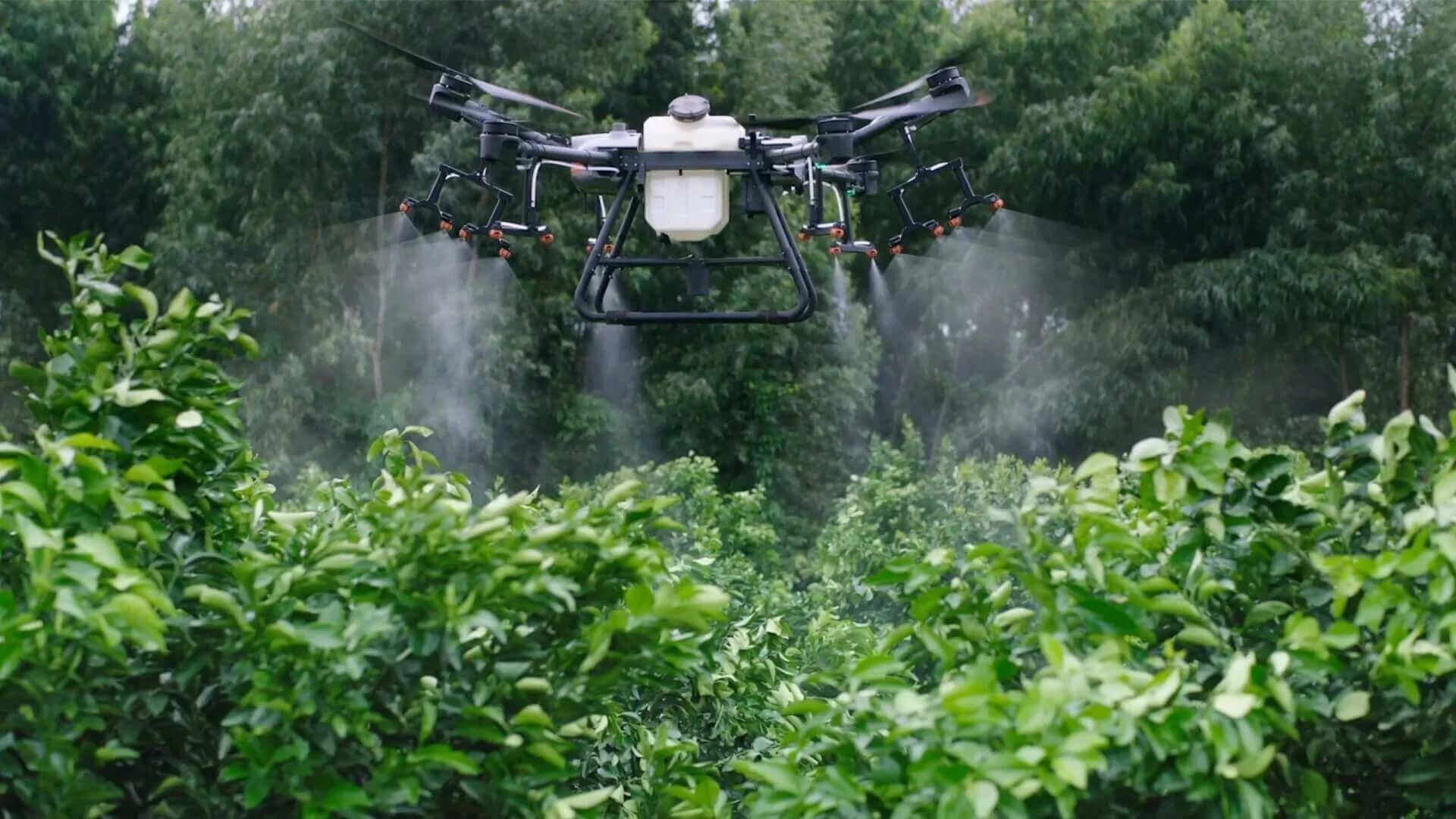
Drones have become integral tools in the agricultural sector, significantly enhancing farm productivity through the timely acquisition of aerial data. These unmanned aerial vehicles are not only responsible for providing crucial information on crop health and facilitating the development of comprehensive NDVI and RGB maps, but they are also actively participating in the day-to-day operations. One notable application is the use of spraying drones, which are employed for distributing fertilizers, herbicides, pesticides, fungicides, seeds, and other essential agricultural inputs.


